The Triangle Tour: Three of Our Nation’s Most Historic Highways
Travel Inspiration
Many years ago, before the creation of the modern interstate highway system by President Dwight D. Eisenhower, travelers drove a nationwide series of named and numbered roads and highways.
The quickest way to traverse the vast expanses of the United States was on the major roadways of the day. These were the days of long “road trip” vacations taken by Americans in the 1940s, ‘50s and ‘60s. Vacationers, however, weren’t the only ones plying these roads and highways. Salesmen, truck drivers, repairmen, builders and farmers were also driving these roads every day to deliver goods and services to American families and businesses.
Three of our nation’s most famous highways are located in or next to the Chicago Southland. The Lincoln Highway, the Dixie Highway and Route 66 all have a close relationship to Chicago and can be accessed from the Chicago Southland. Each is unique in its history, route and reason for being.
The “Triangle Tour” enables visitors traveling to Chicago or the Chicago Southland the unique ability to access any one or all of these three historic highways in one day. For a more in-depth look at attractions and diversions along these historic routes, accommodations are available for overnight travelers or historians.
Let’s begin with some history. The Lincoln Highway is America’s first transcontinental paved roadway. Developed in 1913 by Carl G. Fisher, the Lincoln Highway was conceived to transport people and goods swiftly from one end of the country to the other—east to west—as quickly as possible. Running from Times Square in Manhattan, New York, to Lincoln Park in San Francisco, California, the Lincoln Highway passes through 10 states and is named in honor of our 16th president and one of Illinois’ most recognizable citizens: Abraham Lincoln.
 |
Fisher, founder of the Indianapolis Motor Speedway and developer of Miami Beach, also developed the Dixie Highway in 1914-1915. The Dixie Highway runs north to south from Sault Ste. Marie, Michigan (east route), and Chicago (west route) to Miami Beach, Florida. Built after the Lincoln Highway, Fisher’s motive for creating the Dixie was strictly financial: He wanted to bring Northerners south to buy land in Miami Beach!
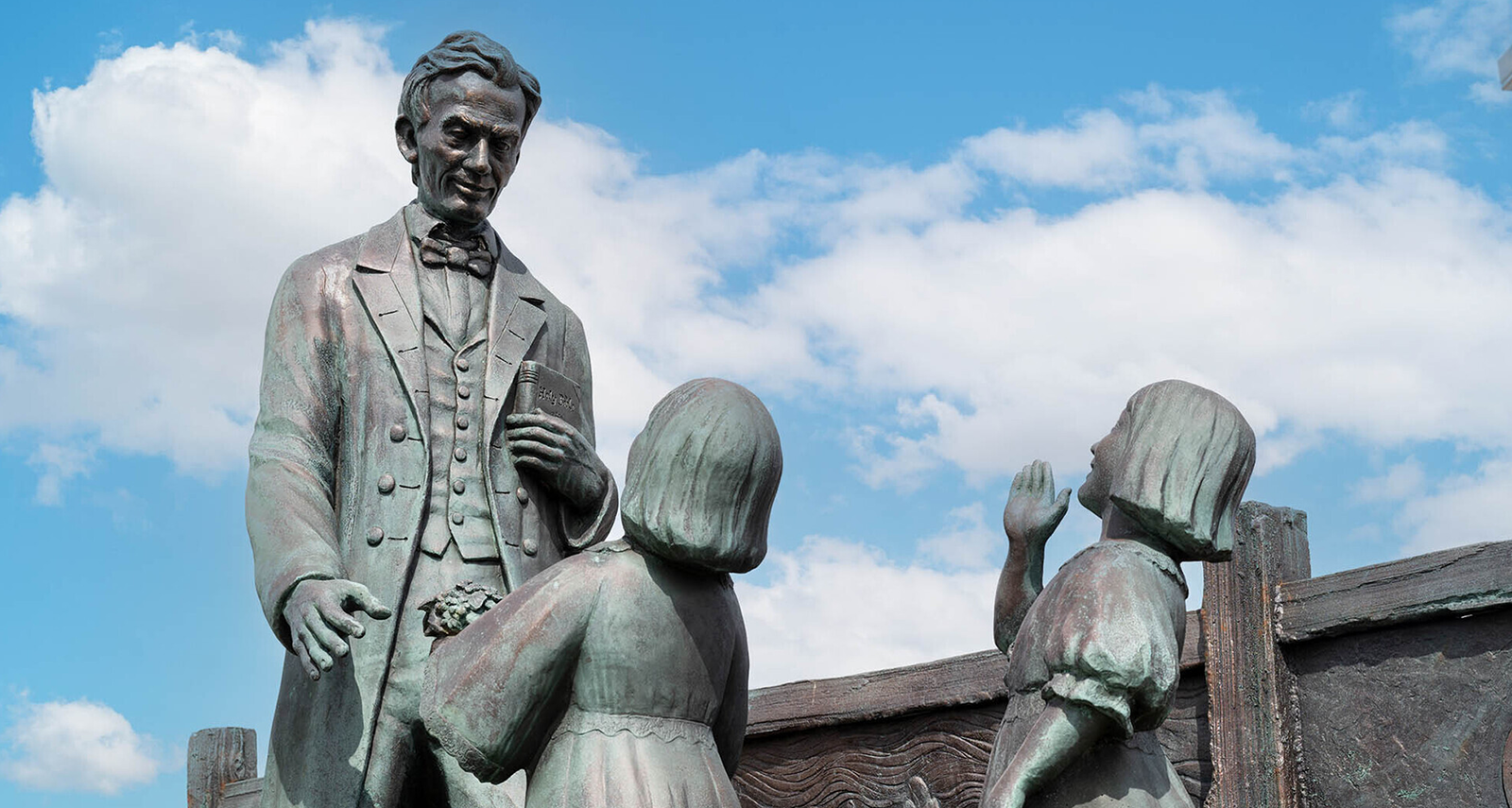
The “Crossroads of the Nation,” located in the Chicago Southland community of Chicago Heights, is where the Lincoln and Dixie highways intersect. The Arche Memorial Fountain (circa 1914), located on the southwest corner of the intersection, was a former wayside for weary travelers and has been faithfully restored to its original condition. Looking northeast on the opposite corner, you’ll see a new bronze statue, “Lincoln on the Road to Greatness.”
The Lincoln and Dixie highways are both precursors to Route 66, conceived in 1926. Also known as “The Mother Road,” Route 66 is perhaps the most famous of any American road. However, some Lincoln and Dixie Highway boosters consider their favorite roads the “Grandpa” and “Grandma” of all American highways! But Route 66, which “winds from Chicago to LA,” still reigns as America’s most popular historic road, as evidenced by the many songs, movies and TV shows that have extolled the virtues of driving this historic route.
Travelers can begin the Triangle Tour on any of the three roadways, but it’s best to travel clockwise from your starting point. On the Lincoln Highway, that would be east to west; on Route 66, southwest to northwest; and on the Dixie Highway, north to south.
Let’s begin the Triangle Tour in the picturesque Chicago Southland village of Homewood. Starting at Dixie Highway and Ridge Road, travel south about one block to Independence Park, where a commemorative plaque noting Dixie Highway’s place in history is located. Continue following the Dixie Highway signs by driving south through Homewood and Flossmoor and into Chicago Heights. Here Dixie Highway merges with Halsted Street (IL Route 1). Travel south two blocks after the merge and you’ll come to the Crossroads of the Nation (mentioned above), where the Dixie and Lincoln highways meet. The Arche Memorial Fountain is on the southwest corner, and the “Lincoln on the Road to Greatness” statue is on the northwest corner. Parking is available in the Chicago Heights Public Library lot at the intersection’s southwest corner for a closer look at these two artifacts.
 We’ll be back for more of the Dixie Highway after we visit the Lincoln Highway and Route 66!
Next, turn right onto US Route 30 (Lincoln Highway) and begin traveling west. On the north side of the road are some of the largest houses in Chicago Heights, many of which were built around the time of the Lincoln Highway’s construction in the period of 1910–1920. Proceeding west on the Lincoln Highway, we enter the village of Park Forest, the nation’s first planned community. The 1950s Park Forest House Museum, Park Forest Historical Society (227 Monee Road, 708-481-4252, ParkForestHistory.org) offers visitors a glimpse back into the late 1940s and early ‘50s when Park Forest welcomed thousands of World War II vets and their growing families. Olympia Fields is just across the Lincoln Highway and has played host to the 2023 BMW Championship along with many other famous golf events.
 The 1950s Park Forest House Museum, Park Forest Historical Society |
Matteson is the next community west along the Lincoln Highway. Originally settled by German immigrants, Matteson was a prosperous farming community along the Illinois Central Railroad and remains a bustling retail center today. The underpass at Governors and Lincoln Highways is the site of the original Illinois Central Railroad alignment, which is still in use today by Metra, the regional commuter rail system.
Matteson is home to the Matteson Historical Society & Museum (813 School Avenue, 708-996-4073, MattesonHistoricalSociety.org) which features a collection of history and artifacts, including obituaries, maps, oral histories, a library of antique books and historical newspaper clippings.
Crossing over Interstate 57, travel west on Lincoln Highway out of Matteson and you’ll see some of the little remaining farmland in Cook County. After about five miles, you will enter the village of Frankfort, settled by immigrant German farmers in 1855 and the highest point between Chicago and the Mississippi River.
Take a left turn (south) on LaGrange Road (US Route 45) and take LaGrange for about two blocks south to the left turn lane onto Old Frankfort Way. This street runs into White Street, where you’ll make a left turn (south) and drive about five blocks into Historic Downtown Frankfort. Here you’ll find the Old Plank Road Trail (OPRT.org), a 22-mile “rails to trails” conversion that runs from Park Forest to Joliet.
Downtown Frankfort’s architecture is mainly from the mid- to late-1800s, as you’ll see when you stroll through the quaint streets and visit the many fine antique and specialty shops in this lovely community. The Trolley Barn and Breidert Green are two interesting locations in Frankfort.
 The Trolley Barn |
Built in 1885, the Trolley Barn once housed trolleys on the old Joliet and Northern Indiana Trolley line. Numerous other rail lines passed through Frankfort, which was known at that time as a “stop on your way west.” Now, the Trolley Barn houses numerous antique dealers and specialty shops, such as Down Home Guitars and This & That Gifts, among many others, making it a one-stop location for your shopping pleasure.
Breidert Green is just across the street, near the old train station along the Old Plank Road Trail. Now the train station is used as a stage for summer concerts and movie screenings, while the green is a busy rest stop for walkers, skaters and cyclists.
Frankfort has a variety of restaurants within walking distance of the shops and the green including Trail’s Edge Brewing Co. (20 Kansas Street, 815-277-2502, TrailsEdgeBrewing.com), Fat Rosie’s Taco & Tequila Bar (28 Kansas Street, 815-534-1640, FatRosies.com) or Francesca’s Fortunato (40 Kansas Street, 815-464-1890, MiaFrancesca.com).
After exploring Frankfort, retrace your route back to Lincoln Highway and continue west. Aurelio’s Pizza (9901 West Lincoln Highway, 815-469-2196, AureliosPizza.com), offers family dining and true Chicago-style pizza, and OPA! Modern Greek Cuisine (10235 West Lincoln Highway, 815-806-7303, Opa-GreekCuisine.com) serves a blend of traditional and modern Greek cuisine. Also, on the north side of the road, you can see remnants of the original Lincoln Highway pavement next to the new bicycle trail.
 Traveling further west along the Lincoln Highway for about 13.5 miles, you will pass Mount Olivet Cemetery into the bustling city of Joliet. Taking a right onto Scott Street (IL Route 53), you are now on old Route 66, aka The Mother Road.
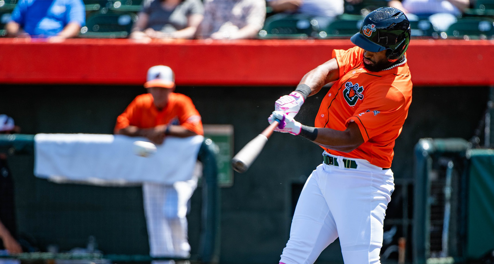
Downtown Joliet offers numerous attractions and restaurants for travelers. The Rialto Square Theatre (102 North Chicago Street, 815-726-6600, RialtoSquare.com) is an ornate, historic theatre that was built in 1926 as a vaudevillian movie palace. Just to the east is Duly Health and Care Field, home of the Joliet Slammers, the town’s own pro baseball team (1 Mayor Art Schultz Drive, 815-651-2042, JolietSlammers.com).
Learn more about Joliet’s history as an industrial powerhouse and transportation center at the Joliet Area Historical Museum (204 North Ottawa Street, 815-723-5201, JolietMuseum.org). The museum also features exhibits on Lincoln Highway and Route 66, so it’s a perfect stop for our historic roads tour!
After exploring downtown Joliet, get back onto Route 66 by finding northbound Scott Street (IL Route 53). Drive about six blocks north to Columbia Street, where Route 66 jogs to the left and under a train viaduct. But before this turn, to the right, is the old Joliet Iron Works Historic Site (31 Columbia Street), now on the National Register of Historic Places and a great stop on our Triangle Tour! Visit the Forest Preserve District of Will County online at ReconnectWithNature.org to learn more about the former Joliet Iron and Steel Works site.
This site is also intersected by the Illinois and Michigan Canal Trail, a path that follows this historic canal route.
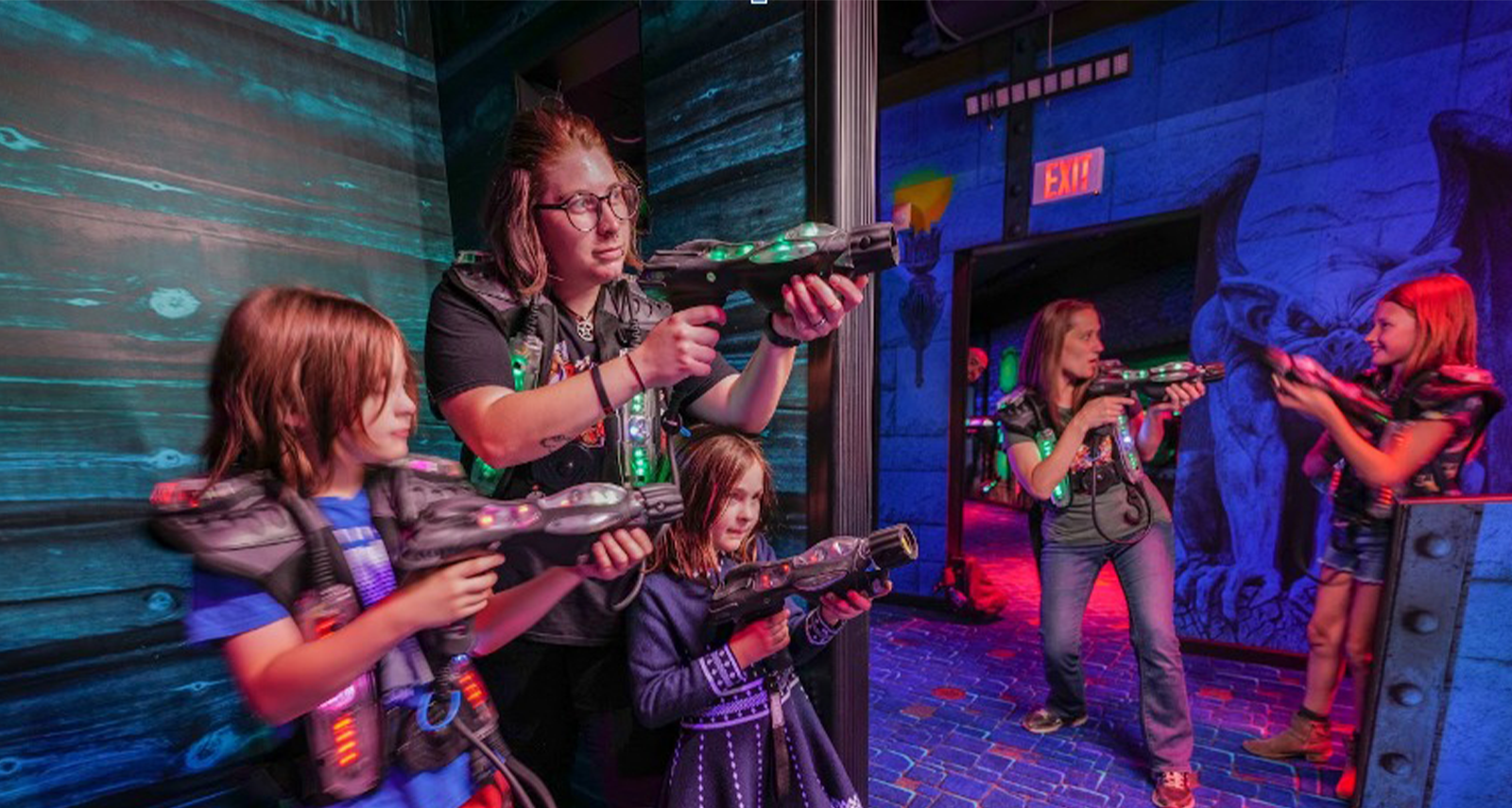
Crossing over the Des Plaines River, take a right and continue following Route 66 north. The Broadway Greenway offers rest stops and views of the Des Plaines River Valley. Children will enjoy Haunted Trails Family Amusement Park & Picnics (1423 North Broadway Street, 815-722-7800, HauntedTrailsJoliet.com), which features mini golf, arcade games, laser tag and go-karts, plus food and refreshments.
Stateville Correctional Center (at IL Route 53 and Stateville Road) contains a historic panopticon cell house, or a “round house,” one of the only structures of its kind still in operation in the US. Just north of Stateville is Lewis University, a Catholic university offering undergraduate and graduate programs, plus an airport and aeronautical course offerings.
Continuing north on Route 66, take a right onto Romeo Road (135th Street) and drive about one mile east to the Isle a la Cache Museum (815-722-9301, 501 East Romeo Road), part of the Forest Preserve District of Will County and a wonderful place to learn about the explorers, fur trappers, traders and Indigenous peoples that once populated the Des Plaines River Valley.
 Isle a la Cache Museum (Photo by Glenn P. Knoblock) |
Be careful to stay on Route 66 along the upcoming stretch of road as you continue northeasterly toward Chicago. You’ll see a left-hand turn off for IL Route 53, but don’t make that turn! Stay on Joliet Road right through the intersection, following the Route 66 signs. White Fence Farm is a famous dinner location suitable for the entire family, located at 1376 Joliet Road (630-739-1720, WhiteFenceFarm-IL.com). The restaurant has been open continuously since the 1920s and has some of the best fried chicken in the entire Chicagoland area. White Fence Farm also offers a petting zoo, musical entertainment and themed shows, a classic auto museum and car shows during the summer months. Be sure to have your dinner in the Route 66 room, one of ten dining rooms in this popular restaurant. Open for dinner only, Tuesday through Saturday, and at noon on Sunday!
After visiting White Fence Farm, just a bit north of 107th Street, the road makes a gradual curve and intersects with Interstate 55. Get on to I-55 (be careful merging into traffic) and continue in a northeasterly direction for about eight miles to the Joliet Road exit (276C). Brown “Historical Route 66” signs will mark this route.
|
|
At the intersection of Joliet and Wolf Roads, there’s a great restaurant to stop at for lunch or dinner: the Wolfs Head Restaurant & Bar (6937 Joliet Road, 708-246-0400, WolfsHeadRestaurant.com). Pick up a sweet treat next door at Old Fashioned Candies (6933 Joliet Road, 708-246-6560, OldFashionedCandiesInc.com). A little further to the northeast at Joliet Road and Brainard Avenue is Rafferty’s Irish Pub (10901 West Joliet Road, 708-246-3188, RaffertysIrishPub.com), a low-key venue that serves traditional Irish and American dishes.
Continuing northwest, you will cross LaGrange Road (US Route 45) and to your right, you’ll see the Quarry Shopping Center. Here, you will find numerous retailers and fast-food establishments.
About one half mile east of LaGrange Road, you must detour around the McCook Quarry! Take Joliet Road/East Avenue north to 55th Street, then turn right (east) on 55th Street. After about one mile, take a left onto Joliet Road again. Traveling north on Joliet Road for about one-half of a mile, you’ll see JC’s Ristorante (8650 Joliet Road, 708-387-0030, JCsRistorante.com), which offers fine Italian selections for lunch and dinner.
Continue driving along Joliet Road through some industrial areas and over the Des Plaines River. After passing through the woods, you will come to Harlem Avenue (IL Route 43). Take a left onto Harlem Avenue, then go north for about three blocks to Ogden Avenue (IL Route 34), making a right.
Driving along Ogden Avenue, you’ll see many references to Route 66, and some of Chicago’s industrial areas. After a few miles, as you near downtown Chicago at Harrison Street, look to the east and you’ll see the John H. Stroger Jr. Hospital of Cook County (1969 West Ogden Avenue), where many scenes from the 1993 movie “The Fugitive” were filmed, and where the television drama “ER” is loosely based on. To the north, you will see the United Center (1901 West Madison Street), home of the Chicago Bulls and Chicago Blackhawks.
Continue to drive northeast on Route 66 (Ogden Avenue) to Jackson Boulevard. Turn right on Jackson and proceed into downtown Chicago. Along Jackson, you will pass the Chicago Police Academy (1300 West Jackson Boulevard). Continue east and, at the intersection of Jackson Boulevard and Halsted Street, you’ll find Chicago’s Greektown neighborhood.
Greektown is a great place to stop for lunch or dinner, with a huge variety of Greek restaurants for your dining enjoyment. Park your car and walk along Halsted Street to experience Greektown firsthand, with Greek bakeries, shops, restaurants and tavernas welcoming visitors from around the world.
Continuing eastward along Jackson Boulevard, you will pass the famous Lou Mitchell’s restaurant (565 West Jackson Boulevard, 312-939-3111, LouMitchells.com), a Chicago classic since 1923 that serves breakfast and lunch. On the next block east is Chicago Union Station (225 South Canal Street), the city’s main train station serving daily commuters and Amtrak passengers. Just across the bridge over the Chicago River, the Willis Tower (233 South Wacker Drive) dominates the skyline. For a great view of Chicago and surrounding states, make a stop at the Skydeck (312-875-9447, TheSkydeck.com), located on the 103rd floor of the Willis Tower.
 Lou Mitchell’s |
Driving east on Jackson Boulevard, amid the buildings between Clark and Dearborn Streets, on the north side, is a monumental sculpture by Alexander Calder titled “The Flamingo.” This 54-foot-high reddish-pink sculpture sits in the John C. Kluczynski Federal Building’s center plaza, located at 230 South Dearborn Street.
Motoring east past State Street, “that great street,” to Michigan Avenue at Jackson Boulevard, you will come to the beginning of the Dixie Highway in the Chicago metro area. Turn right (south) on to Michigan Avenue and you’ll notice The Art Institute of Chicago (111 South Michigan Avenue, 312-443-3600, ARTIC.edu), a must-see on the Triangle Tour.
 The Art Institute of Chicago The Art Institute of Chicago |
The collection of The Art Institute of Chicago contains many of iconic paintings including “American Gothic” by Grant Woods and “Nighthawks” by Edward Hopper, as well a large collection of paintings by Georgia O’Keeffe, among many others. European masterpieces include Gustave Caillebotte’s “Paris Street, Rainy Day” and an iteration of Vincent Van Gogh’s “Self-Portrait,” alongside other works by Salvador Dalí, Paul Gauguin, Claude Monet, Pablo Picasso and Rembrandt.
After visiting the Art Institute, head south just two short blocks to Congress Parkway, and to your left, enter Grant Park to view the magnificent Clarence F. Buckingham Memorial Fountain (301 South Columbus Drive), built in 1927. Known simply as “Buckingham Fountain” to many, the fountain was designed to represent Lake Michigan with its four seahorses to symbolize the four states that touch the lake: Wisconsin, Indiana, Michigan and, of course, Illinois. Fountain designer Edward H. Bennett was inspired by the Latona Basin in Louis XIV’s gardens at the Palace of Versailles.
Moving on south along Michigan Avenue, you will see the hulking behemoth of Soldier Field (1410 Special Olympics Drive, 312-235-7000, SoldierField.com), home of the Chicago Bears and the Chicago Fire FC, to your left in the distance. The Dixie Highway is not marked in Chicago, so please remain aware as you drive through the Chicago portion of the Dixie!
South on Michigan Avenue, at 2120, is Chess Records, a Chicago landmark and the real home of Chicago blues. After emigrating from Poland with their parents as children, brothers Leonard and Phil Chess began their careers as nightclub owners and recording executives in the late 1940s. By the mid-1950s, the likes of Chuck Berry, Willie Dixon, Buddy Guy, Muddy Waters, Howlin’ Wolf and Sonny Boy Williamson had all become household names in the blues and jazz communities and Chicago’s Black community. With their prolific recording and songwriting careers blossoming in the mid-1950s and early 1960s, these artists were instrumental in the British Invasion, influencing the likes of The Beatles, The Rolling Stones, The Who and Cream, among many others.
Chicago’s “Motor Row” was also located along South Michigan Avenue, from approximately the 1400 to 2500 blocks. During the automobile’s early years—the 1920s and 1930s—as many as 116 dealers lined these blocks and several others nearby selling new cars to Chicagoans. Ford, Buick, Chevrolet and Cadillac all had showrooms along South Michigan Avenue, as did other, less familiar names, like Hudson, Marmon and Pierce-Arrow.
Notorious Chicago gangster Al Capone’s first headquarters were in the Metropole Hotel on the northeast corner of 23rd and Michigan. Capone’s last headquarters before he was convicted of tax evasion in 1931 was the Lexington Hotel at 2135 South Michigan Avenue.
At 2400 South Michigan Avenue is the Chicago Defender Building, the former home of the Chicago Defender newspaper, a 100-year-old publication. The Defender has long been the voice of America’s Black community against racism and segregation and led the movement known as the Great Migration. The newspaper relocated in 2005, and the architectural landmark is now an event space that has been restored to its 1930s glamour with Spanish revival details. The area from 22nd Street to Garfield Boulevard (55th Street) came to be known as Bronzeville in the late 1920s and, to this day, retains that name. The Chicago Police Department’s ultra-modern headquarters is located at 3510 South Michigan Avenue.
Further south along Michigan stood the mansions of famous Chicagoans Charles Comiskey and meatpacking magnates Gustavus Swift, Phillip Armour and Michael Cudahy.
At 55th Street, take a right and enter westbound Garfield Boulevard. Garfield is one of Chicago’s grand boulevards, one of a system of boulevards stretching across the city. Our tour will take you west to Western Avenue, but following Garfield Boulevard east takes drivers to the lakefront, the Hyde Park neighborhood, the University of Chicago campus and the Griffin Museum of Science and Industry (5700 South DuSable Lake Shore Drive, 773-684-1414, MSIChicago.org).
 Griffin Museum of Science and Industry |
At Western Avenue, take a left and begin to travel south. At 62nd Street, you’ll see the former site of a large Sears department store, one of the first of hundreds of stores that the famous retailer bought throughout the years. Continuing south on Western Avenue, the original Dixie Highway route, you’ll pass more car dealerships, and at 79th Street, St. Rita of Cascia High School, where Pope John Paul II stayed during his visit to Chicago in 1979 and made an appearance before hundreds of thousands of faithful Catholics.
Continuing south on the Dixie Highway, you will ascend a hill at 83rd Street, coming to the top at 87th Street. This intersection is the highest point in the City of Chicago, and on a clear day, if you look northeast, you’ll see the buildings of downtown Chicago’s iconic skyline.
|
The Original Rainbow Cone |
At 9233 South Western Avenue, you and your traveling partners can experience a true Chicago tradition at The Original Rainbow Cone (773-238-9833, RainbowCone.com) ice cream shop. Travelers along the Dixie Highway stopped at this building back in the 1920s to experience the delight of a Rainbow Cone, a five-flavor ice cream/sherbet concoction that has lived on in Chicago history since that time. The Original Rainbow Cone is served annually at the nation’s largest food festival, the Taste of Chicago.
After a cone, continue traveling south along Western Avenue. At 95th Street, you’ll see The Plaza (9500 South Western Avenue), one of America’s first indoor shopping malls that has since been converted into an open-air shopping center, and continuing south, you will enter the Beverly neighborhood, one of the first historic residential districts in Illinois.
Continuing south on the Dixie Highway, you will enter the City of Blue Island, at 119th Street, where the Dixie Highway now becomes a signed roadway. From 127th Street to the Calumet Sag Channel waterway, you’ll drive through historic downtown Blue Island. Stop in at one of the many fine attractions along Western Avenue, including The Lyric Theater (12952 Western Avenue, 708-972-0700, LyricTheater.com) and the Three Sisters Antique Mall (13042 South Western Avenue, 708-597-3331) which features over 100 dealers. Be sure to also swing by the old Blue Island Opera House, built in 1908, located at 13114 Western Avenue.
 The Lyric Theater |
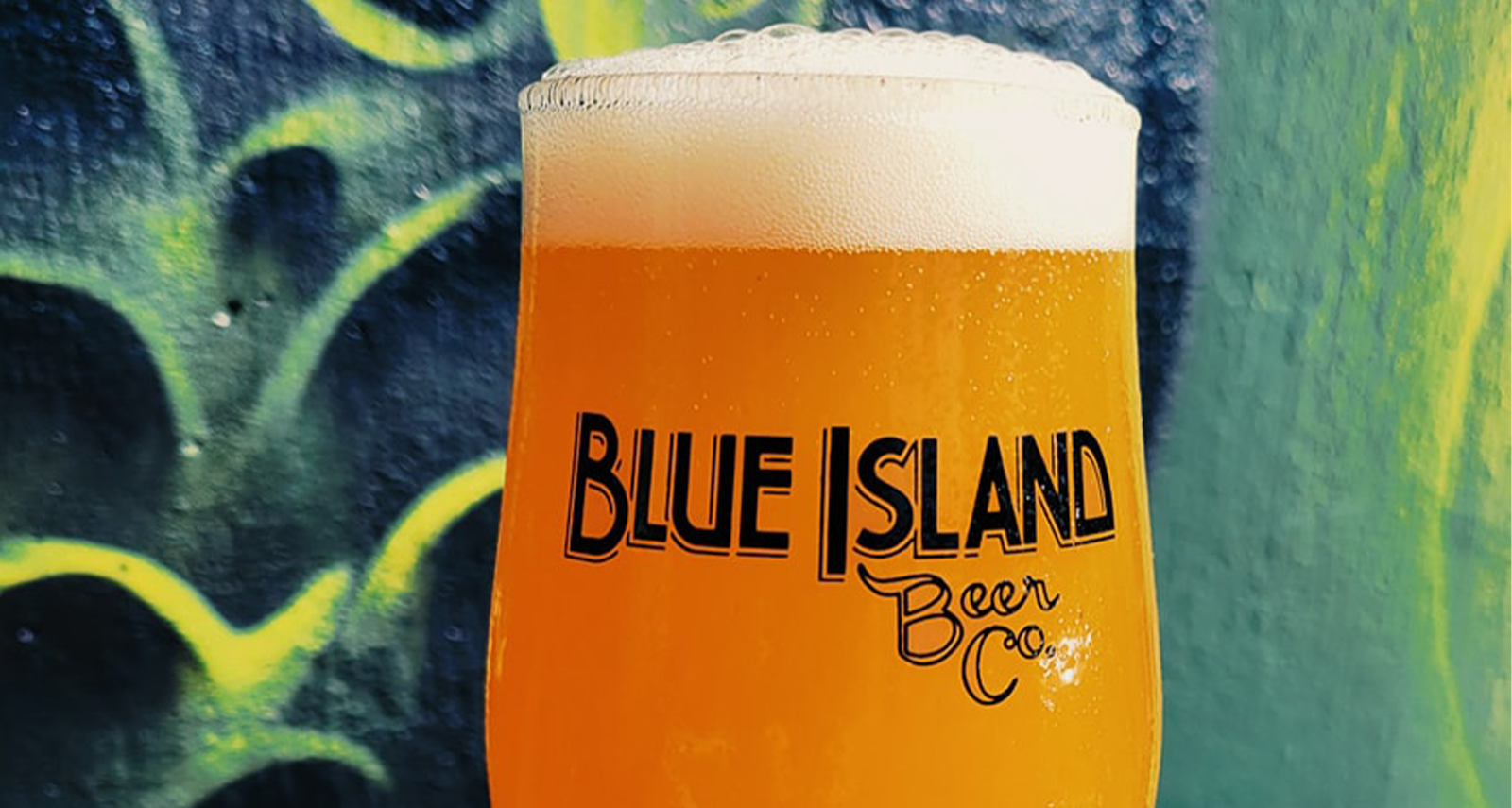
Blue Island is another great place to catch a bite to eat or grab a drink. Continuing south on Dixie Highway (Western Avenue), you’ll cross over the bridge and, staying in the right lane, turn onto Olde Western Avenue, where you’ll find great options. Try City Limits Kitchen & Bar (13414 Olde Western Avenue, 708-631-3661) Natural Law Cocktail Club & Eatery (13404 Olde Western Avenue, 708-629-0120, NaturalLawBlueIsland.com) for some grub, or Blue Island Beer Company (13357 Olde Western Avenue, 708-954-8085, BlueIslandBeerCo.com) for some refreshing specialty brews.
|
Grady’s Snack n’ Dine |
Getting back on Western Avenue heading south, you’ll pass through the suburbs of Posen, Dixmoor and Harvey. Western Avenue is now named Dixie Highway, and at 151st Street, you will see the remnants of Dixie Square Mall, where the mall scene in “The Blues Brothers” movie was filmed. Once a thriving suburban shopping mall, Dixie Square fell into disuse with the construction of newer regional malls.
Following Dixie Highway south again, you will enter Homewood, where we began our Triangle Tour. If you’ve completed this more than 90-mile trip in one day, stop for a respite at Balagio Ristorante (17501 Dixie Highway, 708-957-1650, Balagio-Restaurant.com), Aurelio’s Pizza (18162 Harwood Avenue, 708-798-8050, AureliosPizza.com) or Grady’s Snack n’ Dine (18147 Harwood Avenue, 708-799-4700, EatGradys.com).
That wraps up the Triangle Tour of the Chicago Southland’s historic highways: the Dixie and Lincoln Highways and Route 66. Done in either one day or three separate drives, you’re sure to find something interesting along the way on the Triangle Tour!




THINGS TO DO
EVENTS
DINING
ACCOMMODATIONS
PLAN YOUR TRIP
BLOG
MEETINGS
SPORTS
GROUP TOURS
SOCIAL EVENTS
MEDIA
MEMBERSHIP
ABOUT US
FACEBOOK
YOUTUBE
TWITTER
INSTAGRAM
LINKEDIN
TRIP ADVISOR
CONTACT US SITE MAP PRIVACY POLICY & DISCLAIMER
© Copyright 2001-2025 Visit Chicago Southland. All Rights Reserved. Developed by J Rudny, LLC
19900 Governors Drive, Suite 200| Olympia Fields, IL 60461-1057
(708) 895-8200 | Toll Free (888) 895-8233 | FAX (708) 895-8288